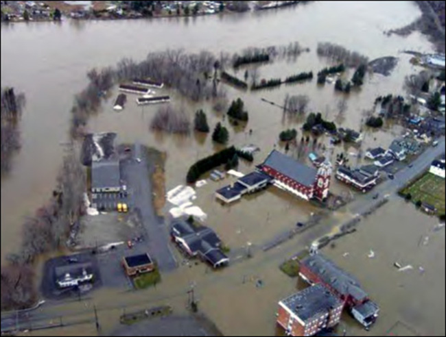
May 1, 2008: Rising rivers throughout northeastern Maine and northwestern New Brunswick drive area residents out, force bridge closures and submerge many businesses and homes in the worst inundation in living memory, caused by 5 inches of rain and a rapidly melting snowpack.

The Aroostook River in Masardis crests at 18.33 feet, a record level. The St. John River peaked at 30.17 feet at Fort Kent – 3 feet higher than the record level of 1979 – the previous night.
Some international bridges to New Brunswick are closed until they can be inspected for damage. Six hundred people are evacuated and 140 homes are flooded.

Flooding at the International Bridge between Fort Kent and New Brunswick on April 30, 2008. Photo by Andrew Cloutier, U.S. Geological Survey
In Van Buren, the water knocks the U.S. Customs port-of-entry building off its foundation. Evacuations also are ordered there, as well as in Mattawamkeag, where the Penobscot and Mattawamkeag rivers are bursting over their banks.
In New Brunswick, the flooding causes more than $23 million (Canadian) in damage.
The flood also causes pollution concerns because overtaxed treatment plants are releasing untreated sewage into the river, and heating oil tanks break free, spilling oil into the floodwater.
There are no reports of death or major injuries.
Joseph Owen is a retired copy desk chief of the Morning Sentinel and Kennebec Journal and board member of the Kennebec Historical Society. He can be contacted at: jowen@mainetoday.com.
Send questions/comments to the editors.


Comments are no longer available on this story